
Waterfall
Major multi tiered waterfall formed by the Maskeliya Oya, known for its height and strong flow.
Major multi tiered waterfall formed by the Maskeliya Oya, known for its height and strong flow.

Hike
Reached via steps and walking paths descending into the valley. Moderate physical effort required, especially on the return climb.
Reached via steps and walking paths descending into the valley. Moderate physical effort required, especially on the return climb.

Scenery
Deep gorge, steep rock faces, rising mist, and surrounding tea estates and forested slopes.
Deep gorge, steep rock faces, rising mist, and surrounding tea estates and forested slopes.

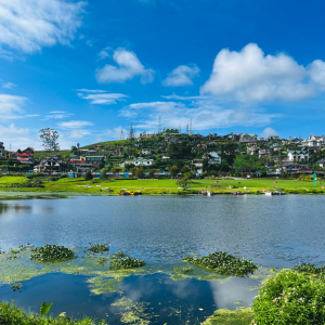
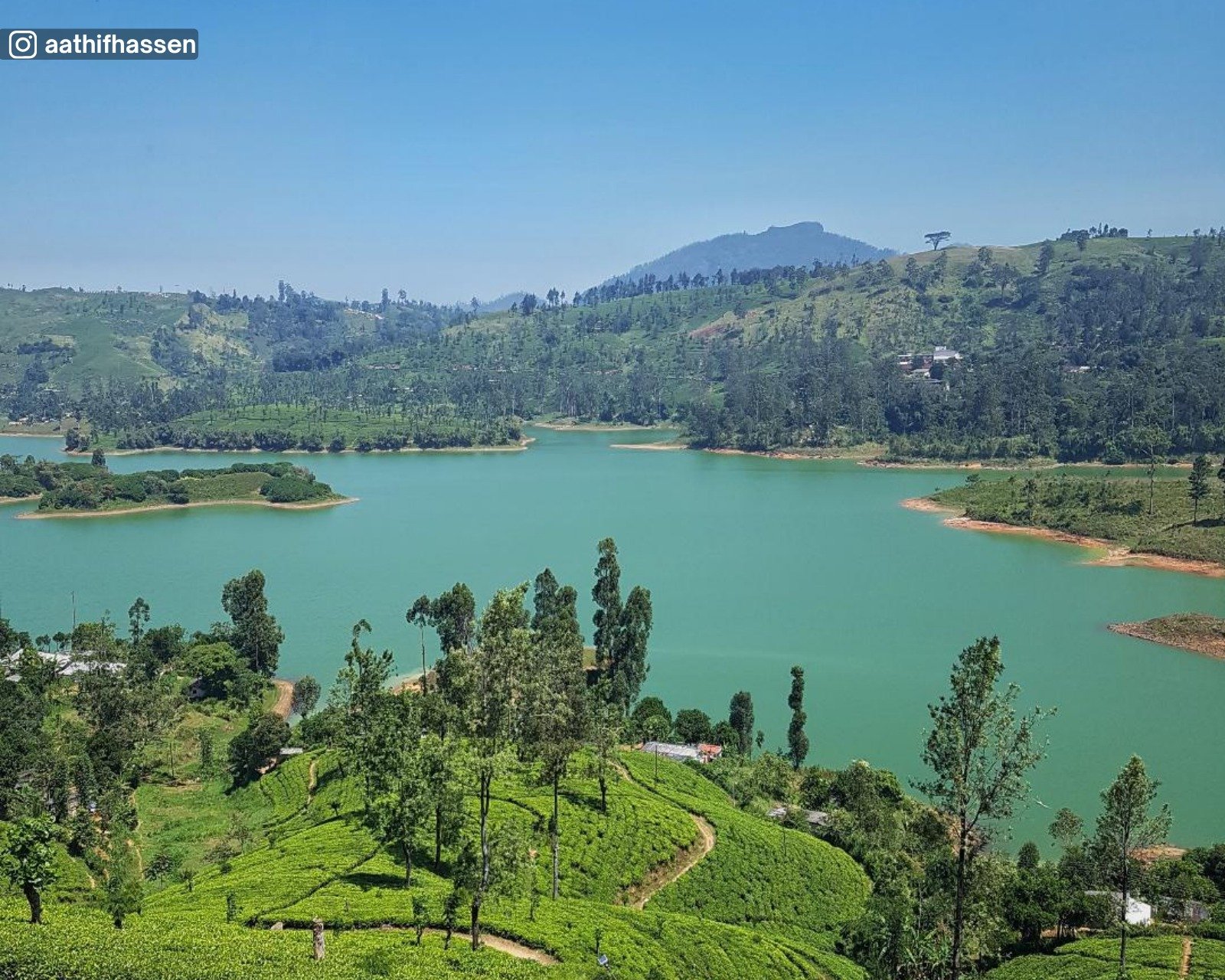
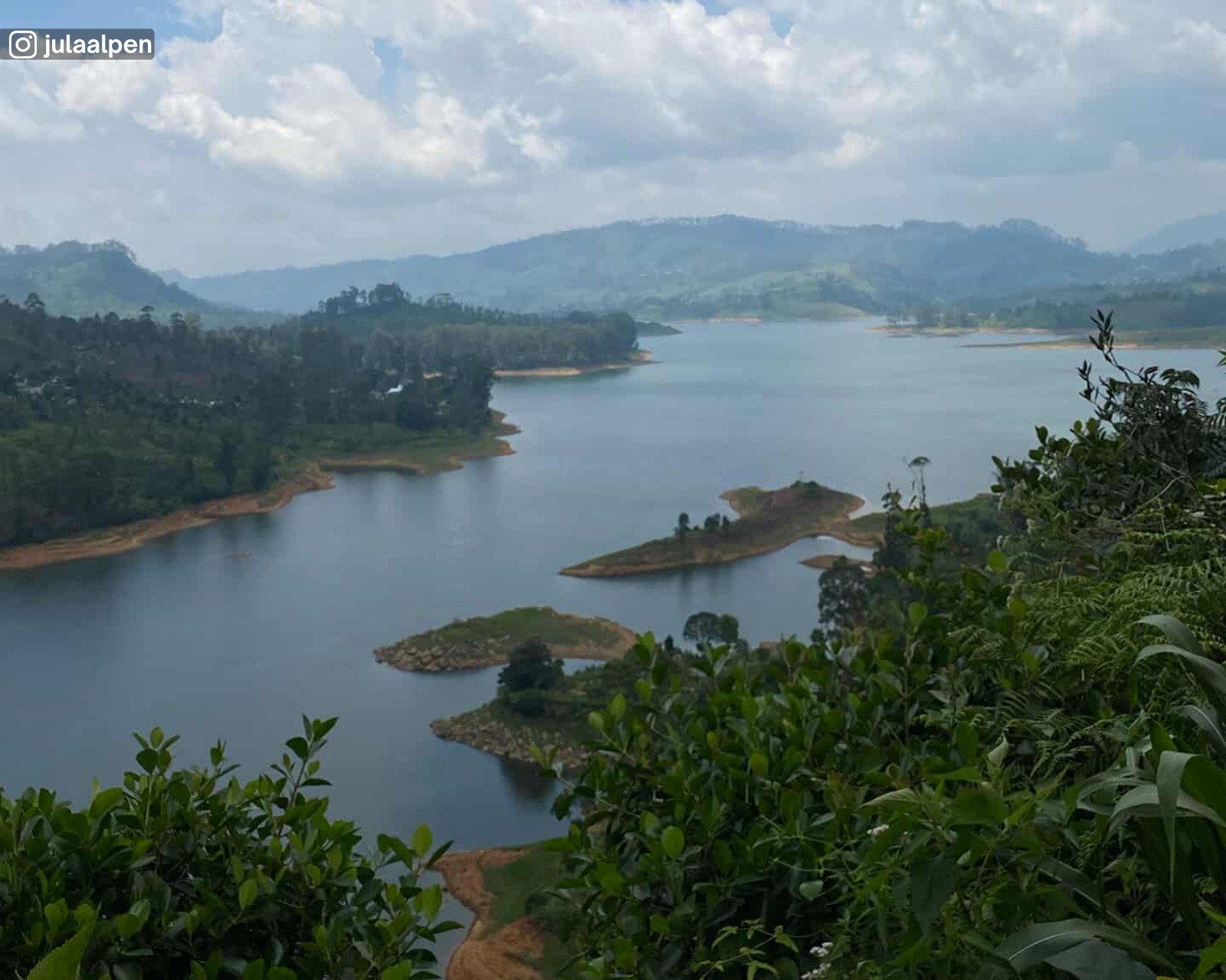
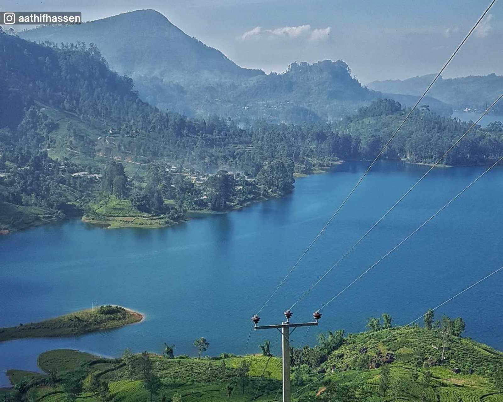
Lake
Highland reservoir formed by damming the Maskeliya Oya, supporting hydroelectric power generation.
Highland reservoir formed by damming the Maskeliya Oya, supporting hydroelectric power generation.
Scenery
Wide open water, tea estate covered hills, misty surroundings, and layered highland views.
Wide open water, tea estate covered hills, misty surroundings, and layered highland views.

History
Constructed during the British colonial period in the early 20th century as part of the Laxapana hydroelectric scheme.
Constructed during the British colonial period in the early 20th century as part of the Laxapana hydroelectric scheme.

Church
Historic Anglican church belonging to the Church of Ceylon.
Historic Anglican church belonging to the Church of Ceylon.
History
Built in the late 19th century during the British colonial period to serve plantation communities in the Dickoya area.
Built in the late 19th century during the British colonial period to serve plantation communities in the Dickoya area.
Scenery
Tea estate surroundings, misty hills, and a quiet highland setting. Colonial era Anglican design with simple Gothic features, timber interiors, and stained glass elements.
Tea estate surroundings, misty hills, and a quiet highland setting. Colonial era Anglican design with simple Gothic features, timber interiors, and stained glass elements.

Waterfall
Tall seasonal waterfall descending from tea estate highlands into a forested valley.
Tall seasonal waterfall descending from tea estate highlands into a forested valley.
Scenery
Tea plantations, steep cliffs, forested slopes, and open highland views. Viewed from nearby estate roads and viewpoints. Direct access to the base is limited and not commonly used.
Tea plantations, steep cliffs, forested slopes, and open highland views. Viewed from nearby estate roads and viewpoints. Direct access to the base is limited and not commonly used.
Waterfall
Tall, narrow waterfall flowing over a steep rock face within a tea estate setting.
Tall, narrow waterfall flowing over a steep rock face within a tea estate setting.
Scenery
Tea plantations, forested slopes, rocky cliffs, and quiet highland surroundings. Viewed from nearby estate roads and footpaths. Direct access to the base is limited and not commonly used.
Tea plantations, forested slopes, rocky cliffs, and quiet highland surroundings. Viewed from nearby estate roads and footpaths. Direct access to the base is limited and not commonly used.
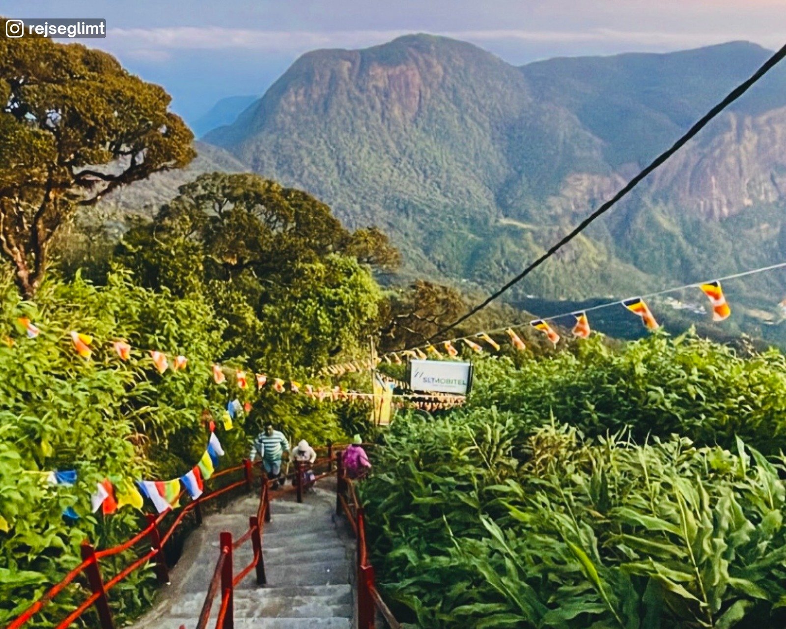
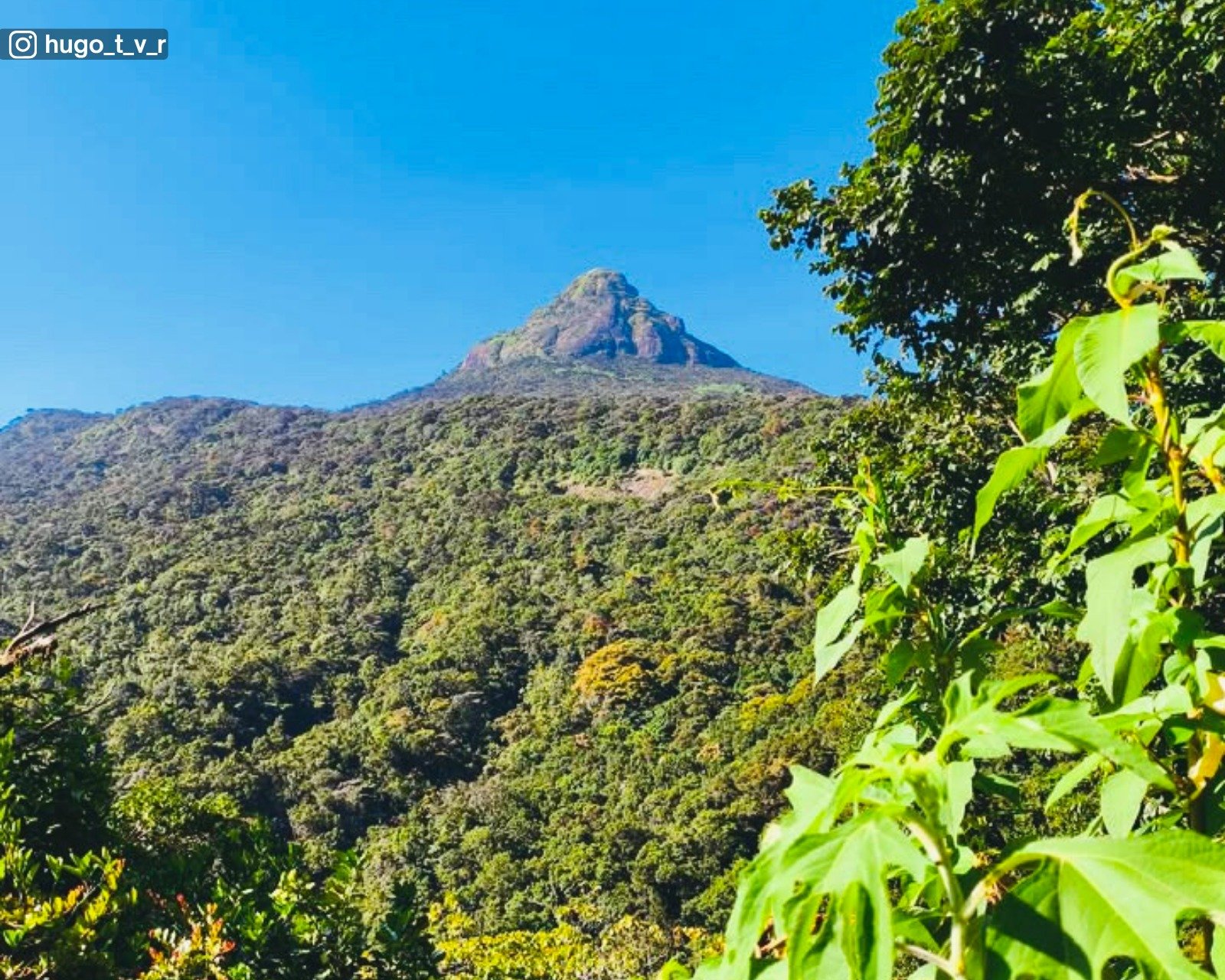
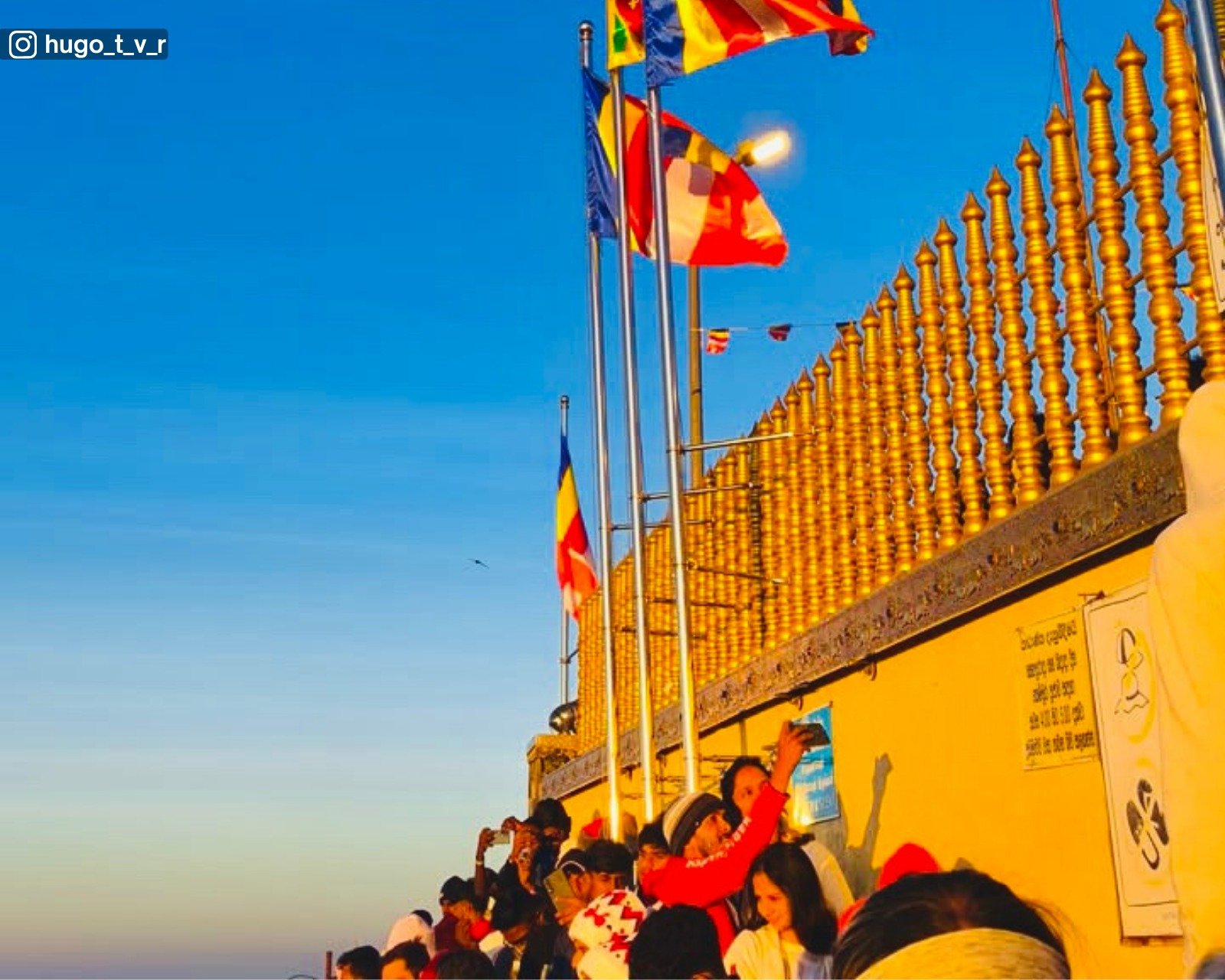
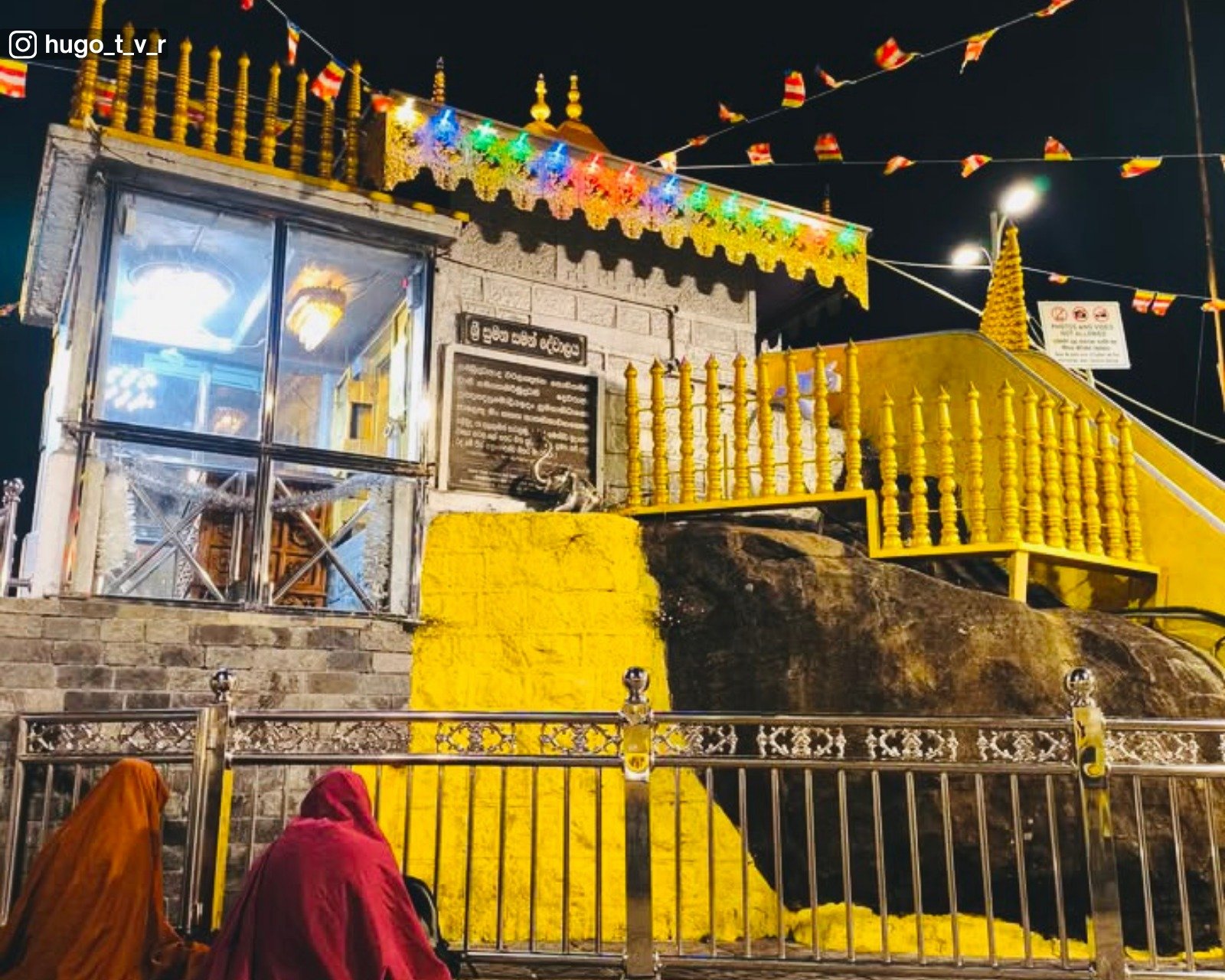

Sacred Site
Major pilgrimage site revered by Buddhists, Hindus, Muslims, and Christians.
Major pilgrimage site revered by Buddhists, Hindus, Muslims, and Christians.
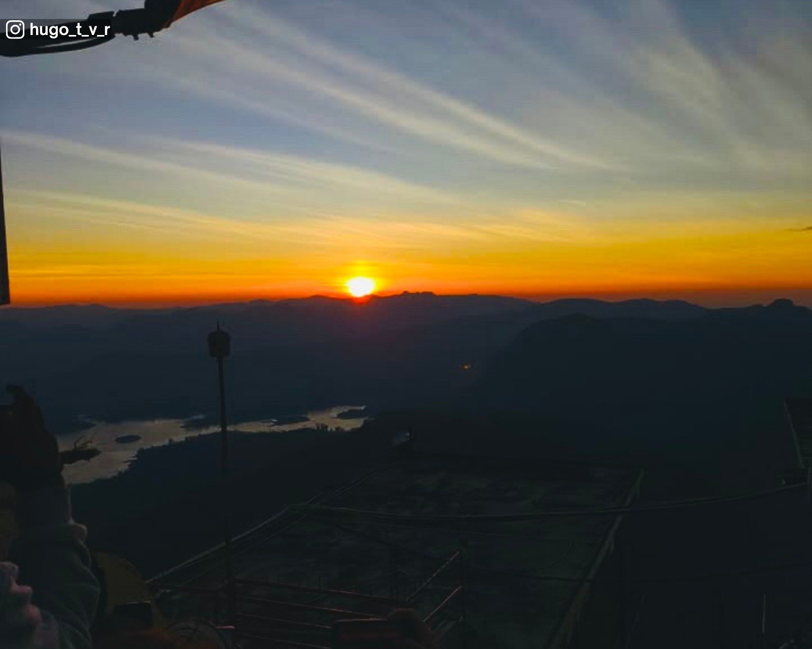
Hike
Challenging climb involving thousands of steps. Typically takes 4–6 hours to ascend, depending on pace and starting point.
Challenging climb involving thousands of steps. Typically takes 4–6 hours to ascend, depending on pace and starting point.
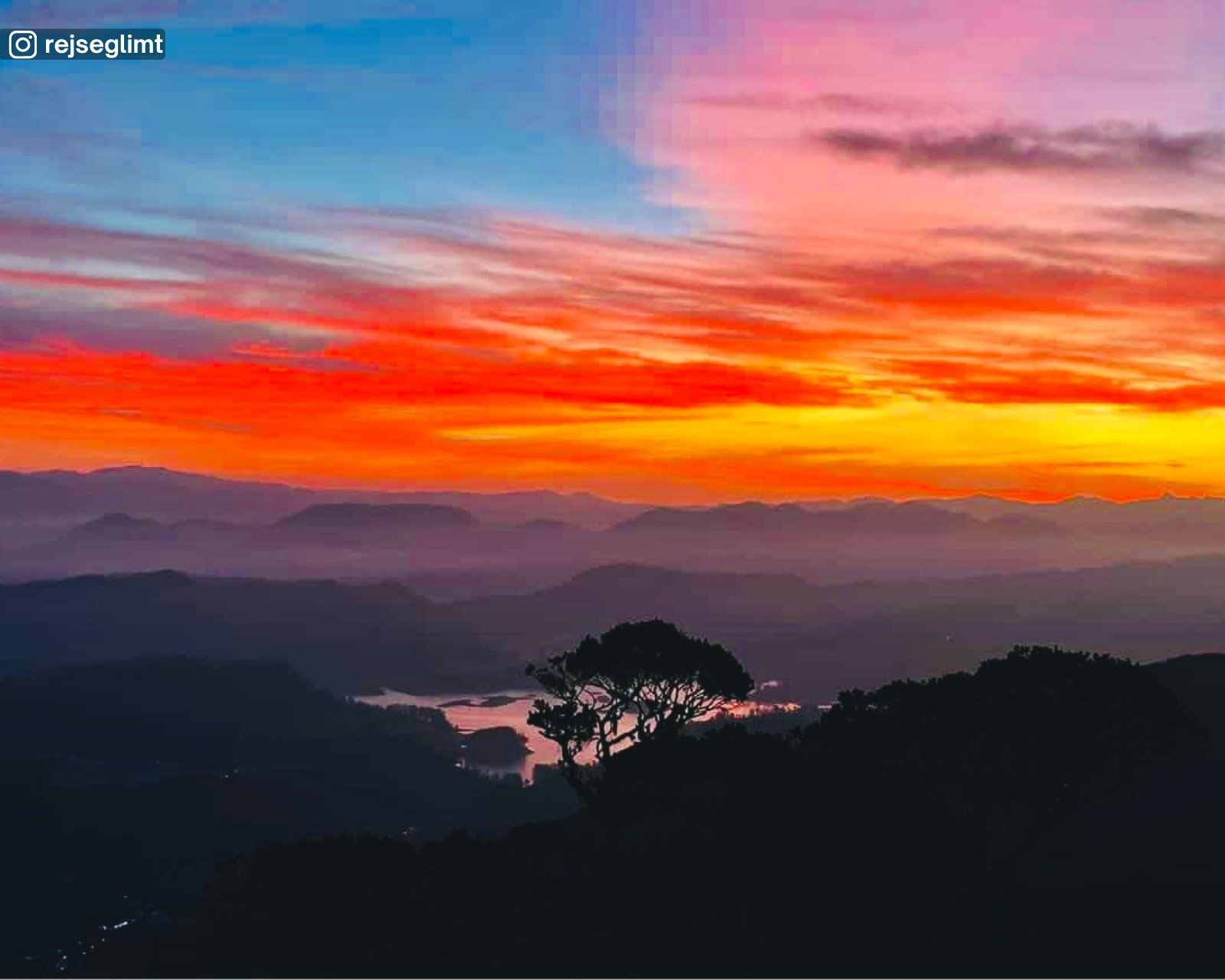
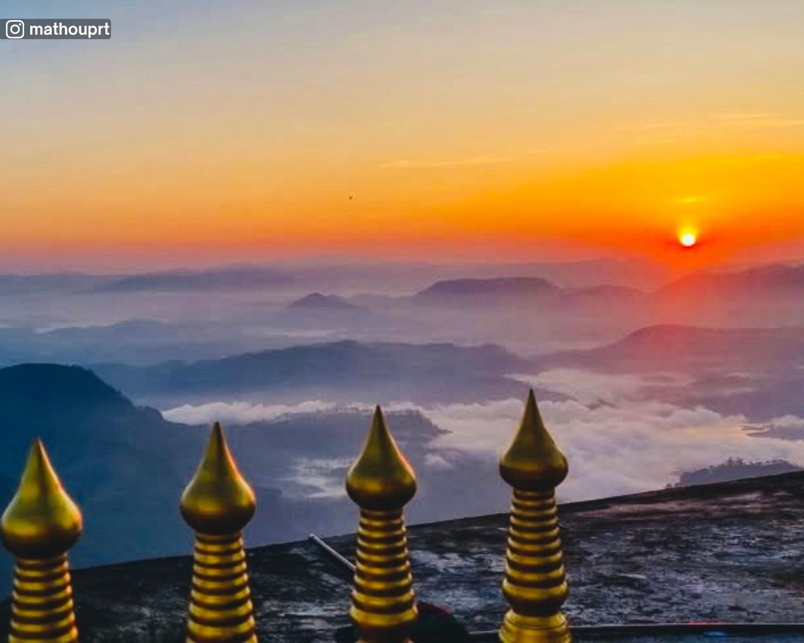
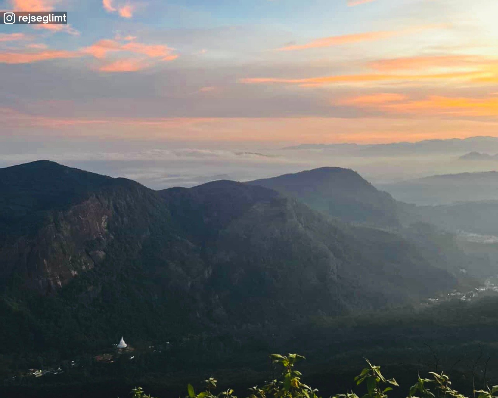
Scenery
Forested slopes, mountain ridges, mist filled valleys, and expansive sunrise views from the summit.
Forested slopes, mountain ridges, mist filled valleys, and expansive sunrise views from the summit.
History
A sacred site for centuries, centred around the footprint at the summit known as Sri Pada, associated with multiple religious traditions.
A sacred site for centuries, centred around the footprint at the summit known as Sri Pada, associated with multiple religious traditions.

Art & Culture
A living pilgrimage tradition shaped by shared rituals, symbols, lamps, and practices from multiple faiths centred around the sacred footprint.
A living pilgrimage tradition shaped by shared rituals, symbols, lamps, and practices from multiple faiths centred around the sacred footprint.
Lake
Highland reservoir formed by damming the Maskeliya Oya, supporting hydroelectric power generation.
Highland reservoir formed by damming the Maskeliya Oya, supporting hydroelectric power generation.
Scenery
Wide open water, tea estate covered hills, misty surroundings, and layered highland views.
Wide open water, tea estate covered hills, misty surroundings, and layered highland views.
History
Constructed during the British colonial period in the early 20th century as part of Sri Lanka’s early hydroelectric power development linked to the Laxapana scheme.
Constructed during the British colonial period in the early 20th century as part of Sri Lanka’s early hydroelectric power development linked to the Laxapana scheme.

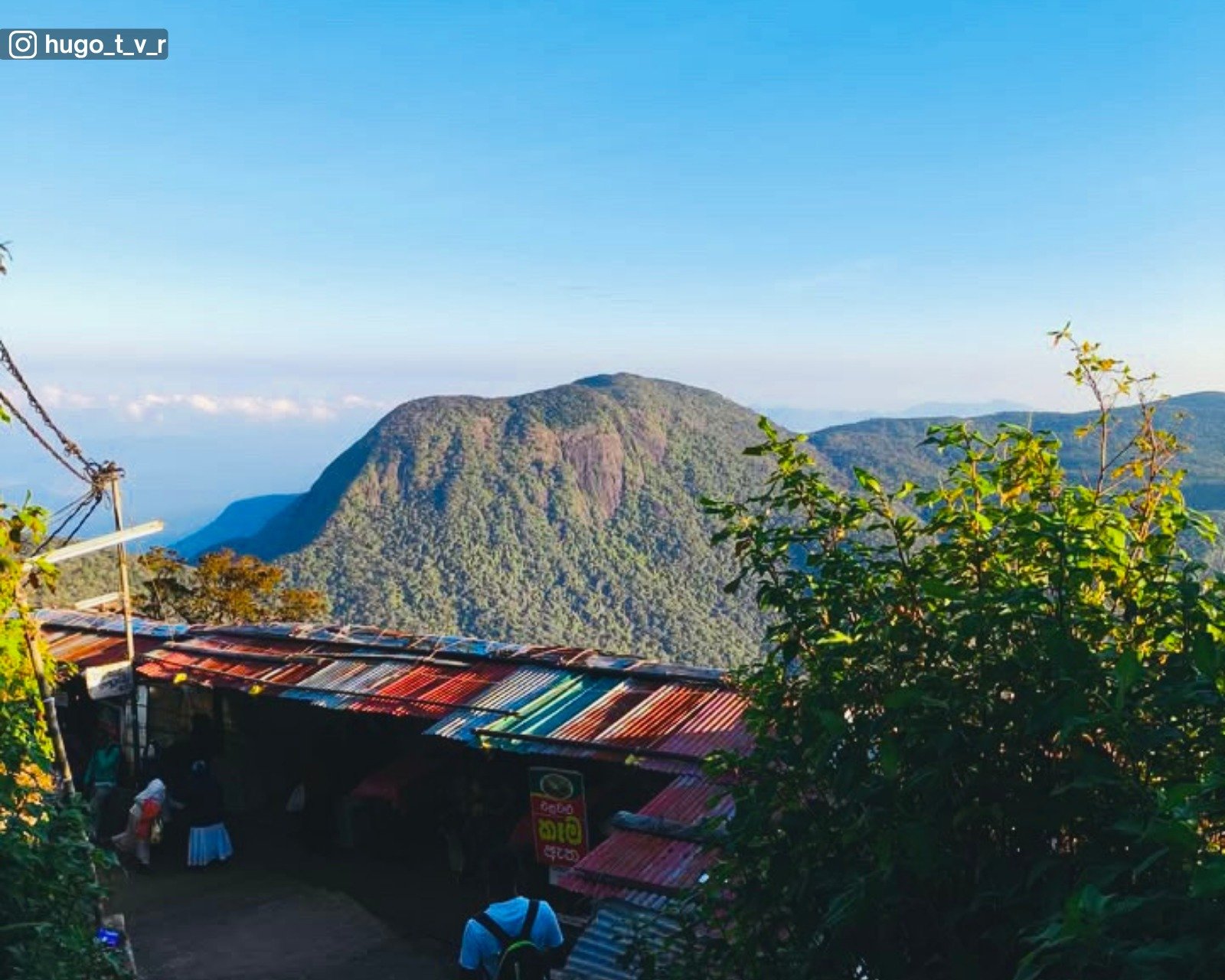
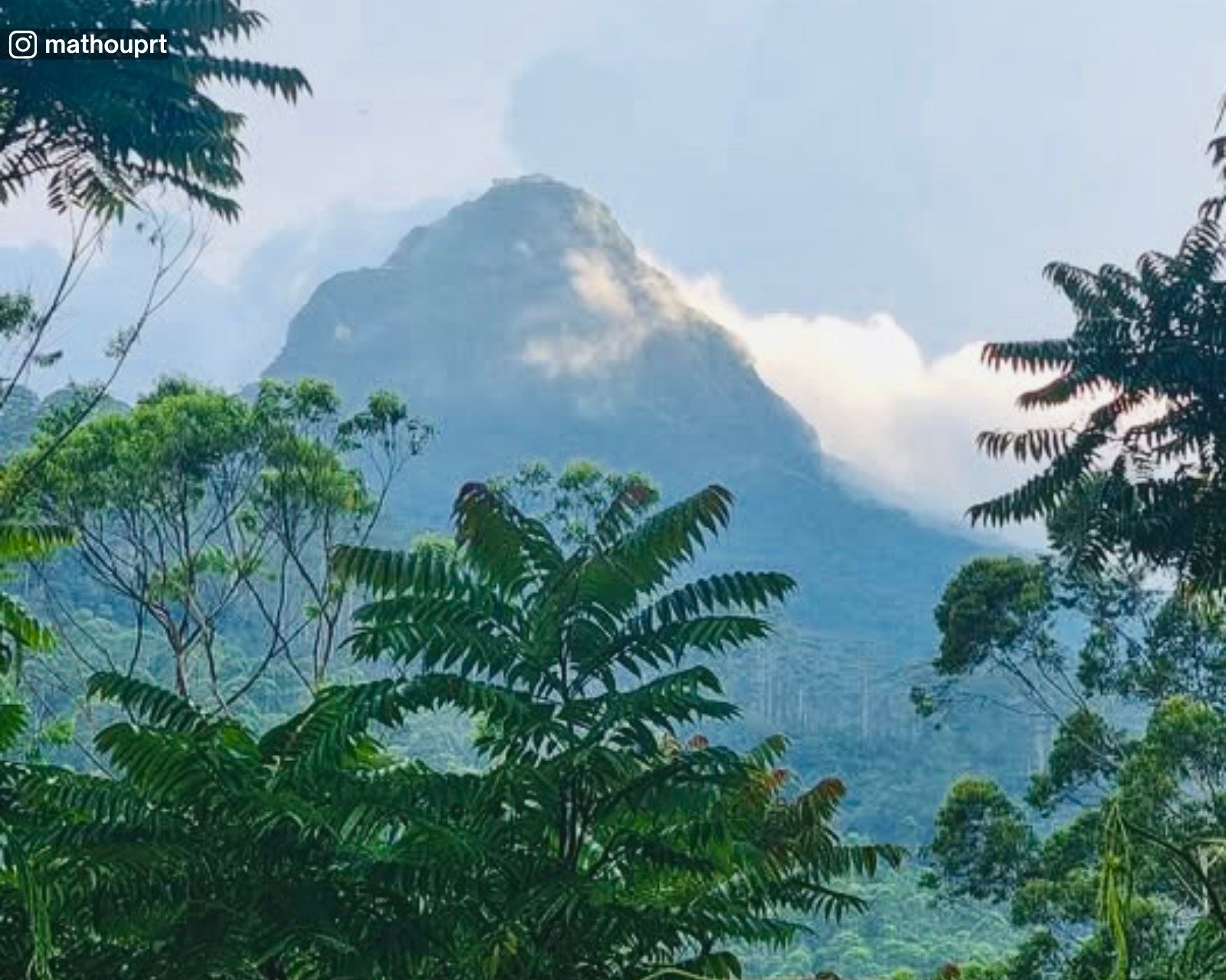
Mountain Range
A line of seven prominent peaks forming a recognizable highland silhouette near Maskeliya.
A line of seven prominent peaks forming a recognizable highland silhouette near Maskeliya.
Scenery
Layered mountain ridges, mist covered peaks, forested slopes, and wide highland views.
Layered mountain ridges, mist covered peaks, forested slopes, and wide highland views.
Mountain / Plateau
Highland mountain with a broad summit area and surrounding steep slopes near Maskeliya.
Highland mountain with a broad summit area and surrounding steep slopes near Maskeliya.
Hike
Short to moderate uphill hike that can take around 30–45 minutes from nearby access points, depending on route, pace, and weather conditions.
Short to moderate uphill hike that can take around 30–45 minutes from nearby access points, depending on route, pace, and weather conditions.
Scenery
Open highland views, forested areas, tea estate surroundings, and layered mountain ridges.
Open highland views, forested areas, tea estate surroundings, and layered mountain ridges.
Waterfall
Tall single drop waterfall plunging into a deep forested gorge near Maskeliya.
Tall single drop waterfall plunging into a deep forested gorge near Maskeliya.
Hike
Reached via steps and forest paths descending into the valley. Moderate physical effort required, especially on the return climb.
Reached via steps and forest paths descending into the valley. Moderate physical effort required, especially on the return climb.
Scenery
Steep rock faces, dense greenery, mist from falling water, and a dramatic highland setting.
Steep rock faces, dense greenery, mist from falling water, and a dramatic highland setting.
Church
Historic Anglican church associated with plantation era Christian communities in the Hatton area.
Historic Anglican church associated with plantation era Christian communities in the Hatton area.
History
Established during the British colonial period to serve estate and local Christian communities around Hatton.
Established during the British colonial period to serve estate and local Christian communities around Hatton.
Scenery
Tea estate surroundings, misty hills, and a quiet highland setting.
Tea estate surroundings, misty hills, and a quiet highland setting.
Church
Historic Anglican church associated with plantation era communities in the Maskeliya region.
Historic Anglican church associated with plantation era communities in the Maskeliya region.
History
Established during the British colonial period as part of the Church of Ceylon to serve estate and local Christian communities.
Established during the British colonial period as part of the Church of Ceylon to serve estate and local Christian communities.
Scenery
Quiet highland setting surrounded by tea estates, misty hills, and rural roads.
Quiet highland setting surrounded by tea estates, misty hills, and rural roads.
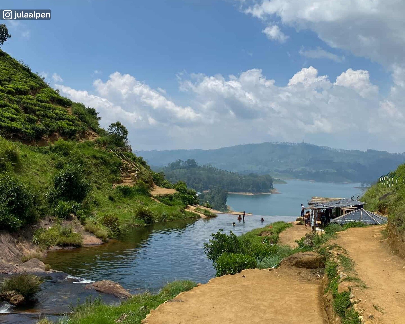
History
Submerged remains of the former Maskeliya town affected by the creation of Maussakelle Reservoir.
Submerged remains of the former Maskeliya town affected by the creation of Maussakelle Reservoir.
Lake
Flooded during the early 20th century as part of British colonial hydroelectric and reservoir development linked to the Laxapana scheme.
Flooded during the early 20th century as part of British colonial hydroelectric and reservoir development linked to the Laxapana scheme.
Scenery
Calm reservoir waters with occasional visibility of submerged structures during low water levels.
Calm reservoir waters with occasional visibility of submerged structures during low water levels.
Waterfall
Wide roadside waterfall formed by the Kothmale Oya, known for its graceful drop into a deep valley.
Wide roadside waterfall formed by the Kothmale Oya, known for its graceful drop into a deep valley.
Scenery
Tea estates, steep valleys, forested slopes, and open highland views.
Tea estates, steep valleys, forested slopes, and open highland views.
Hike
While the main viewpoints are roadside, short walks through grass and vegetation may be needed for alternate angles. Leeches are common in wet conditions, so proper footwear and precautions are recommended.
While the main viewpoints are roadside, short walks through grass and vegetation may be needed for alternate angles. Leeches are common in wet conditions, so proper footwear and precautions are recommended.
Waterfall
Tall, narrow waterfall descending from tea estate highlands into a forested valley.
Tall, narrow waterfall descending from tea estate highlands into a forested valley.
Scenery
Tea plantations, steep rock faces, forested slopes, and quiet highland surroundings.
Tea plantations, steep rock faces, forested slopes, and quiet highland surroundings.
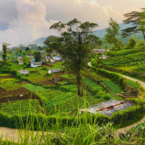
Plains / Grassland
Open highland grassland area with wide views and gently rolling terrain near Maskeliya.
Open highland grassland area with wide views and gently rolling terrain near Maskeliya.
Hike / Walk
Suitable for relaxed walking across open ground. Easy to moderate effort depending on route and distance.
Suitable for relaxed walking across open ground. Easy to moderate effort depending on route and distance.
Scenery
Expansive open plains, distant mountain ridges, misty mornings, and broad highland skies.
Expansive open plains, distant mountain ridges, misty mornings, and broad highland skies.